Here’s the final blog post from our cross-country cycling trip. The 3,800+ miles that we cycled only required 80 riding days, but we managed to stretch it out into a five-month journey.

After riding out of St. George, UT, we passed through the northwest corner of Arizona on our way to Nevada. The most direct route would have been to cycle on the interstate, but a more relaxing and legal option is to take a northwestern route through the Shivwits Indian Reservation.

After reaching the crest of the climb on Old Highway 91 out of St. George, we were treated to a 17-mile descent.

The long descent also carried us through the northwest corner of Arizona. It was a short stay, though. After only about two or three hours of pedaling we crossed the border into Nevada.


Here’s my odometer clocking the 3,000th mile of the trip. We didn’t know it at the time, but there were just 821 miles (1,330km) between us and the end of the ride…

We rolled into Mesquite, NV at dusk, and low on water. We struck up a conversation with a local, Alfred, who offered to fill our water bottles. One thing led to another, and he wound up letting us camp out on his patio, too. Alfred and his wife were another example of the kind of quality folks we encountered in the western states.

A desert scene west of Mesquite, NV

A desert scene west of Mesquite, NV

The road out of Mesquite was pretty mellow. Most of the traffic gravitates toward I-70, on the other side of the valley. Unfortunately, we were eventually forced to ride on I-70. I suspect there was a minor, unpaved alternative route that we missed.

Apparently we weren’t the smallest and most vulnerable critters on the road. This horny toad lizard was about the size of a dime.

We discovered this lousy stencil when we pulled off the main road for a little break under an overpass.

On our second night in Vegas we linked up with Eyna’s friend from the Philippines, Koji. He was kind enough to drive us around downtown and show us some of the sights.

A chocolate fountain.

An artisanal glass ceiling in a casino.


Boom.


Eyna and I don’t drink, gamble, or dance, but we have a deep appreciation for sweets.

Our time in Vegas coincided with the sprouting of a new branch on the Madrid family tree.

After an extended stay in Vegas with family and friends, we pedaled 65 miles to the border town Pahrump, NV. The following morning we rode into the 13th and final state of our trip.

Our first night in California was spent on public land just outside of Death Valley.

The weather was perfect. If we were passing through in the summer, though, we would have been confronted by temperatures in excess of 120 degrees.

A perfect, secluded site.


A gentile 500 foot climb out of Shoshone, CA put us at Ibex pass.

A resident of Ibex Pass. This guy was easily the size of my hand.

A tarantula with 8.5 legs?


In Yermo, we met a waitress who was from Rockville, MD.


Notice the warning message on the top right side of this bulletin board in a cafe in Boron, CA. A bit disconcerting, isn’t it? There were quite a few towns in the Mojave desert that had been polluted by toxic spills, dumping, or leakage of industrial chemicals.

I had heard such great things about California, but I developed a different impression during our ride. The inland area was post-apocolyptic, and the coast was crowded and commercialized. It was also the only state where we experienced unprovoked hostility from drivers, who beeped at us and even tried to run us off the road in a few cases.

Here’s a vista of an abandoned shop on polluted scrubland. This is a pretty typical scene for the Mojave region.


There were a few stretches where we counted literally dozens of syringes along the side of the road in a span of just a few miles.

The good news is that firemen are friendly wherever you go. The guys at the New Cuyama firehouse allowed us to camp on their lawn and use their shower. They’re a pretty entertaining bunch, too.

Here’s our campsite on the lawn of the New Cuyama firehouse.

Mike seemed to do most of the cooking and cleaning around the firehouse…

Here we are, ready to roll out of New Cuyama. Just a few more days to the coast…

The scenery was more interesting in the hills that flank the coast than in the Mojave desert.


It was along this stretch of road that we met a grizzled old cyclist that had ridden down from the Pacific northwest. He planned to ride to San Diego and then continue on to South America. Before we parted ways he told us, “Don’t stop riding. You don’t have any excuse. I’m 76, and I’m still going.”


OUR FIRST GLIMPSE OF THE OCEAN! To be honest, it was a bit anticlimactic. I imagined cresting a ridge and having the clouds part to reveal a sweeping view of the Pacific. I never imagined we’d have to peer under a railroad bridge at a hazy sliver of sea.

That’s a little better. I believe this is near Santa Barbara.

A moment almost 4,000-miles in the making.

The first Filipino to cycle across the United States?

Aaaaaaand we’re STILL married!!!

Look at my beautiful Irish tan! You can’t get that kind of color without spending four straight months in the beating sun.


The black object in the water is a sea lion.

Pelicans.

We arrived at Eyna’s aunt, uncle, and cousin’s house on Thanksgiving day. Here we are the day after our arrival…

In LA, we clogged Eyna’s family’s apartment with bikes, panniers, camping equipment, and all manner of pads, tablets, laptops, netbooks, smart phones, etc. Then we made an even bigger mess by tearing everything apart and packing it into boxes to ship home. Many thanks to Tito Jun, Tita Myrna, and Migz for letting us occupy their living space for a few days. After everything was packed we sent three large boxes stuffed full of bikes, wheels, camping kit, etc. The cost was outrageous. I spent more shipping our bikes home than I did on our one-way plane tickets back to DC. I would recommend riding a bike with a frame that can be broken down, like the Surly Trucker Delux or the Ritchy Breakaway Cross. The latter comes highly recommended for touring from two very experienced international cycle tourists in Moab, Barb and John.
Statistics:
October 16: St. George, UT to Mesquite, NV, 52.54 miles in 5 hours and 35 minutes
October 17: Mesquite, NV to Moapa, NV, 33.92 miles in 3 hours and 36 minutes
October 18: Moapa, NV to North Las Vegas, NV, 56.95 miles in 6 hours and 3 minutes
October 19: North Las Vegas, NV to Las Vegas, NV, 23.41 miles in 2 hours and 29 minutes
October 20: Las Vegas, NV to Henderson, NV, 19.62 miles in 2 hours and 5 minutes
November 9: Henderson, NV to Pahrump, NV, 62.17 miles in 6 hours and 36 minutes
November 10: Pahrump, NV to Shoshone, CA, 27.23 miles in 2 hours and 54 minutes
November 11: Shoshone, CA to Baker, CA, 56.16 miles in 5 hours and 58 minutes
November 12: Baker, CA to Yermo, CA, 51.44 miles in 5 hours and 28 minutes
November 13: Yermo, CA to Barstow, CA, 15.18 miles in 1 hour and 26 minutes
November 18: Barstow, CA to Boron, CA, 39.47 miles in 4 hours and 12 minutes
November 19: Boron, CA to Tehachapi, CA, 52.37 miles in 5 hours and 34 minutes
November 20: Tehachapi, CA to Bakersfield, CA, 53.62 miles in 5 hours and 42 minutes
November 22: Bakersfield, CA to Maricopa, CA, 43.89 miles in 4 hours and 40 minutes
November 23: Maricopa, CA to New Cuyama, CA, 23.95 miles in 2 hours and 33 minutes
November 24: New Cuyama, CA to Santa Maria, CA, 54.48 miles in 5 hours and 48 minutes
November 25: Santa Maria, CA to Buellton, CA, 33.25 miles in 3 hours and 32 minutes
November 26: Buellton, CA to Carpinteria, CA, 54.81 miles in 5 hours and 49 minutes
November 27: Carpinteria, CA to Malibu, CA, 57.59 miles in 6 hours and 7 minutes
November 28: Malibu, CA to Carson, CA, 41.09 miles in 4 hours and 22 minutes
Total Miles: 853.14 miles
Tags: adventure cycling, arizona, baker, bakersfield, barstow, beard, bike, black bike, boron, buellton, california, camping, carpinteria, carson, chocolate fountain, coast, complete cycling tour, couple, cross country, cross country cycling trip, cycle touring, cycling, cycling across the US, cycling california, cycling couple, cycling east to west, cycling nevada, cycling tour, death valley, descent, desert, dime, diner, downhill, drug addicts, eyna, filipino, filipino cycling, filipino cyclist, firehouse, first filipino, henderson, horny toad lizard, i came to america and all i did was this lousy stencil, i-70, ibex pass, interstate, kanesonbikes, las vegas, lawn, lousy stencil, malibu, maricopa, married, mesquite, moapa, mojave desert, nevada, new cuyama, north las vegas, odometer, old highway 91, pacific coast, pacific ocean, pahrump, patio, paul, paul & eyna, paul and eyna, pelican, philippines, pink bike, rockville, san bernardino county, santa barbara, santa maria, sea lion, ship home, shivwits paiute indian reservation, shoshone, st. george, surly, surly long haul trucker, surly troll, syringe, syringes, tarantula, tehachapi, thanksgiving, tunnel, United States, utah, waitress, water, yermo
Utah is generally lower altitude and warmer than Colorado. Summer temperatures regularly break into the triple digits in southern Utah, but things begin to cool off in September. By the time October arrives the weather is perfect for cycling.
With that in mind–and with the threat of wintery conditions behind us in Colorado–we set a leisurely pace in the Beehive State. A week spent lounging around Moab was followed by a day exploring Staircase Escalante National Monument by car with a friend, and then a couple days resting in St. George. Between those breaks we covered fewer miles, too, averaging only 48.19 miles per day.
As it turns out, Utah was a great place to linger. The landscapes were the best we’ve seen yet, and the Utahans we encountered were some of the most interesting, active, and welcoming people we’ve ever met, anywhere.
Here are some images and stories about the people and landscapes we happened upon in The Finest State in the Union…

The Department of Transportation’s rendering of Utah’s red rock country.

The only high-mileage day in Utah was our first day in the state. We rode almost 75 miles from Grand Junction, CO to a campsite about 40 miles from Moab. We arrived in the dark, and left late the next morning thinking we’d have an easy ride into Moab…

The ride to Moab was incredibly scenic. The road wound through a red rock canyon, hemmed in between the Colorado river on one side and sheer ruddy cliffs on the other.

Traffic was light, too. It would have been a mellow introduction to southern Utah…if it weren’t for the blistering headwind that began howling through the canyon 30 minutes into the ride.

At this point, we were still able to appreciate the scenery, despite the headwind.

As the day wore on, however, moral began to plummet and we found it harder and harder to appreciate our surroundings.

Breathtaking

Closing in on Moab…

In Moab we stayed with our favorites: John and Barb. These two made our time in Moab the best days of the trip.

John took us on a hike to the red rock cliffs behind his house.

We skirted a golf course on the way to the cliffs.

This scene is a ten minute walk from John and Barb’s door. It’s hard to not be jealous.

Approaching the base of the cliff.

Here’s Eyna picking her way through a very thorny and rocky environment…in flip-flops and short shorts.

Hiking shoes are just too bulky, she says.

After a couple days in Moab we bid farewell to Barb and John. Our plan was to ride to the town of Green River, about 60 miles to the northwest, but we decided to take a detour when we reached the entrance to Arches National Park.

Most of the sandstone arches aren’t visible from the road. It was already late in the afternoon, so we decided to camp and explore the (surprisingly limited) network of hiking trails for views of the arches the following day.

Our campsite in Arches National Park. Not too shabby.

Pouring a cup of the morning brew and thinking about our plans to see some of those famous arches…

…Awwwww, nuts. A ranger delivered the bad news just as we were breaking camp. The rangers in Arches were unhelpful and unfriendly, too.

This is the closest we got to an arch on the 25-mile ride back to the park entrance.

Our only photo op.

On the upside, the roads in the park were completely traffic-free.

Definitely not an arch, but still impressive…

The descent to the park entrance.

Mrs. Madrid-Kane winding her way through switchbacks.

The ride from Arches NP to Green River and then on to Hanksville involved a few monotonous stretches.

Things began to get a little more interesting again as we approached Hanksville.

Our campsite in Hanksville next to a gas station. This was obviously not the most attractive locale, but it’s nice to have a reliable water source a few steps from “camp.”

Hanksville is only a couple hours ride from Capitol Reef National Park. The roadside geology displays are impressive even before entering the park proper. This scene is just outside Hanksville, on public land.

Utah’s national parks deserve their reputation for stunning landscapes and intricate geologic formations, but the parks are so highly regulated and they see so many tourists that a visit doesn’t feel much like a wilderness experience. Other public lands offer more opportunities for solitude and adventure. In Utah’s national forests, visitors can hike, camp, and build campfires almost anywhere. The scene above is on public land between Hanksville and Capitol Reef NP.


Minerals stain the landscape.

Capitol Reef National Park

Capitol Reef National Park

Capitol Reef National Park

Capitol Reef National Park

Capitol Reef National Park

The road that we followed through Capitol Reef eventually deposited us in the small settlement of Torrey, UT. Our Warm Showers host, Lyman, lived on the outskirts of town at the foot of a red rock cliff.

In Torrey, we camped out on Lyman’s basement floor. Just as we were dozing off, Eyna noticed we were not alone. The results of a frantic google search suggested this was an Arizona Bark Scorpion. The Bark Scorpion delivers the most unpleasant sting of the half dozen North American scorpion species, but, fortunately, it isn’t considered life threatening for the average healthy adult.

The next day we were treated to a guided tour of Boulder Mountain and Grand Staircase Escalante National Monument by one of Utah’s native sons, Dr. Wayne J. Hintze. Dr. Wayne also filled in as our portrait photographer for the day. Here’s a photo he took of us at a view point on Boulder Mountain.

Boulder Mountain was awash in golden brown and yellow aspens.

This part of Utah is peppered with petrified sand dunes.


Dr. Wayne and Mrs. Kane atop a petrified sand dune.

Wayne sure does know a lot about Utah and sand and rocks.

Some desert details…

Volcanic rock and celest blue lichen

I’m lichen it.


Desert shrubbery.

Wrought Juniper


Let’s live here!

Coyote on the run.

A view into the “Water Pocket Fold” in Grand Staircase Escalante National Monument.

Grand Staircase National Monument: All the beauty and splendor of the National Parks without so many pesky regulations.

That would be cross-bedded sandstone in the background.

A view from the flanks of Boulder Mountain.

The Mrs.

The day after our tour with Wayne we rode out of Torrey, bound for Otter Creek National Park. Along the way we came across a dead hawk. We’ve seen dead opossums, deer, a few coyotes, and innumerable raccoons (apparently the least situationally aware mammal in the lower 48), but this was the first bird of prey in some 3,000 miles.

A mouse’s worst nightmare.

Pasture land before Loa, UT.

Loa is guarded by a Danny Trejo mannequin in a squad car from the 80’s.

We decided to spend the night in Loa. After hunting around for a half hour, we found a place to camp out in a local’s garage.

Just outside Otter Creek State Park.

The view from our camp in Otter Creek State Park.
At 3.5 pounds, our tent is a bit light and flimsy. Having an ultralight shelter normally isn’t an issue, but on this particular day the weather forecast called for strong wind and snow. After mulling over our options we chose to take shelter in a picnic pavilion. The structure had three walls to block the wind, which seemed like enough protection from the elements, so we chose to sleep on our sleeping pads on the floor without setting up the tent. That turned out to be a bad idea. Twice during the night I was awakened by a sound and discovered a large skunk well within my personal space. The first time it was a few inches from my legs, and the second time it was pacing around next to my head. What do you do to frighten a skunk enough that it retreats, but not so much that it sprays you?

The stretch of road between Otter Creek State Park and Kingston, UT was our favorite.

Dixie National Forest…open for fishing, hiking, and camping. Who needs the National Parks?

Dixie National Forest

Approaching Orderville, UT during a 17-mile descent.

Outside Orderville, UT

Outside Orderville, UT

From our campsite in the town park in Orderville, we followed a backroad that took us past Coral Pink Sand Dunes State Park and onto the Utah-Arizona state line. After spending the night just over the border in Arizona, we planned to ride northwest to St. George, UT.

Entering the 11th state of the trip.

The pavement disappeared at the border and we found ourselves struggling to stay upright on a sandy, washboard surface.

Some sections of the road were quite smooth…and scenic.

Other areas were a little rougher.

The eight miles of dirt and sand were a little more exciting than a standard asphalt surface.


We chose our destination for the day based on mileage: looking at the map, we found a town that was about 50-60 miles away and decided to ride there and look for a place to pitch our tent. We didn’t know anything about the town before we arrived, other than the fact that it was a convenient stop. Our stay in Colorado City, AZ turned out to be a very unique cultural experience…

The first thing we noticed was that most of the homes were surrounded by 7-8 foot tall fences.

It wasn’t a very inviting town. The people we saw didn’t look very threatening though…most of them were children, and all of them looked clean cut and straight laced.

It turns out Colorado City, AZ is a polygamous community. That explained the insularity. On the other hand, all of the people we met in town were friendly and polite, and no one appeared unhappy or depressed…

We wound up camping in the town park that evening.

Aaaand one more flat on the way into St. George, UT. This time the offender was a big chunk of glass. More frequent flats are often a sign that it’s time to change tires. I’ve swapped out my well worn Continental Travel Contact tires for a new pair of the discontinued Schwalbe Marathon XR’s here in Las Vegas. The Travel Contacts served me well for over 3,500 miles. We will see how the Schwalbes do…
Statistics:
September 24: Grand Junction, CO to Dewey Bridge, UT, 73.06 miles in 7 hours and 49 minutes
September 25: Dewey Bridge, UT to Moab, UT, 39.04 miles in 5 hours and 45 minutes
October 3: Moab, UT to Green River, UT, 57.17 miles in 6 hours and 26 minutes
October 5: Green River, UT to Hanksville, UT, 60.38 miles in 7 hours and 6 minutes
October 6: Hanksville, UT to Torrey, UT, 54.30 miles in 6 hours and 50 minutes
October 8: Torrey, UT to Loa, UT, 18.80 miles in 2 hours and 33 minutes
October 9: Loa, UT to Otter Creek State Park, UT, 47.64 miles in 6 hours and 19 minutes
October 10: Otter Creek State Park, UT to Panguitch, UT, 44.31 miles in 5 hours and 59 minutes
October 11: Panguitch, UT to Orderville, UT, 46.72 miles in 5 hours and 4 minutes
October 12: Orderville, UT to Colorado City, AZ, 42.97 miles in 5 hours and 22 minutes
October 13: Colorado City, AZ to St. George, UT, 45.73 miles in 4 hours and 51 minutes
Total miles: 530.12 miles
Tags: adventure cycling, arches, Arches National Park, arizona, arizona bark scorpion, aspens, basement, bicycle, bike, black bike, boulder mountain, camping, capitol reef national park, cliff, co, coffee, colorado city, continental travel contact tires, coral pink sand dunes state park, cow, coyote, cycle touring, cycling, cycling across the united states, cycling across the US, cycling utah, department of transportation, dewey bridge, dirt and sand, dixie national forest, eyna, federal government shutdown, fishing, garage, gas station, golf course, grand junction, grand staircase national monument, green river, hanksville, hawk, headwind, hiking, juniper, kanesonbikes, kingston, lichen, loa, mannequin, Moab, national park, orderville, otter creek state park, panguitch, pannier, paul, paul and eyna, petrified sand dune, pink bike, rocks, sand, sandstone, schwalbe marathon xr, schwalbes, scorpion, skank, st. george, starbucks, switchbacks, torrey, ut, utah-arizona border, warmshowers, water, water pocket fold
When we departed Maryland in July we weren’t sure if we would make it to the Rocky Mountains before snow and freezing temperatures closed the higher mountain passes to cyclists. From the common room of a hostel in Moab, UT, we are pleased to report that we made it through the mountains before the winter weather arrived.
Here’s a look back at our ride across the great state of Colorado…

After quite a few bland days in western Kansas, we finally reached the Colorado border.

Unfortunately, the geography of eastern Colorado isn’t the stuff of Mountain Dew commercials. The town of Eads, CO looked like just another sorry sight in western Kansas. Here’s our campsite behind the town’s rest stop.

In this photo you can see Eyna’s personal bike mechanic reinstalling her wheel after patching a flat. Overall, we’ve had good luck with punctures: in the first 2,500 miles we have only had to deal with four flats.

Eyna’s mechanic also dialed in her brake pads in anticipation of heavy braking on long descents in the Rockies.

The pads on my rim brakes had worn pretty thin, too. Fortunately, swapping them out only takes about ten minutes and requires no tools.

On the way to Ordway, CO, we stopped in a small cafe in Sugar City that had a very authentic, retro feel. Prices were reasonable, too. Eyna’s set lunch of pulled pork was only $5.50, including two sides and coffee.

Everything in the place looked vintage, right down to the coffee mugs.

The pie looked delicious, but we discovered the baker used some sort of gelatinous filler layered between the apples. The only disappointing aspect of the Sugar City Cafe…

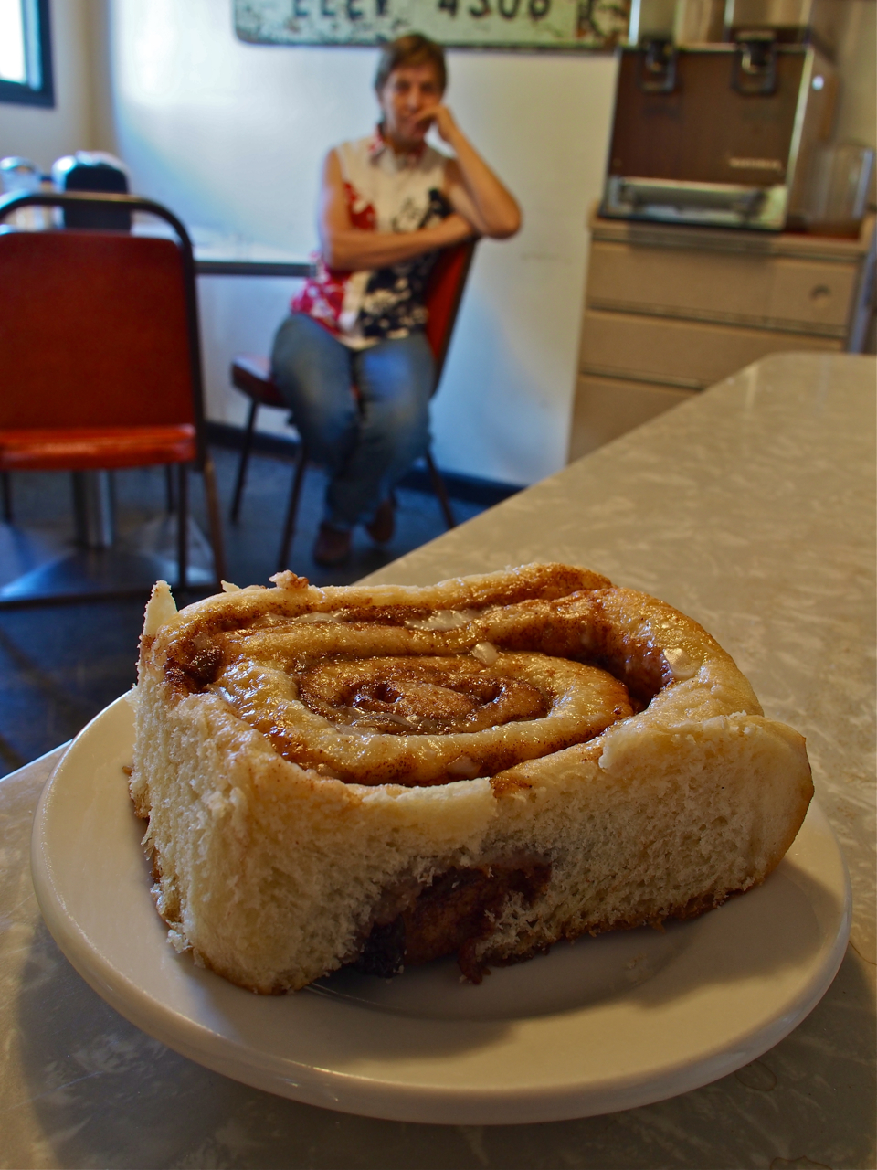
A generously portioned cinnamon bun. That would be the mercurial owner-operator of the Sugar City Cafe perched in the background.

We picked up some intel at the Sugar City Cafe about an accommodation opportunity in the nearby town of Ordway. The rumors turned out to be true, and a few hours later we found ourselves staked out in a modified RV on a farm just outside of town.

The owner, Gillian, is an expat from New Zealand. She seems to devote most of her time, money, and property to caring for stray critters: turkeys, geese, ducks, chickens, guinea fowl, goats, dogs, horses…and cyclists.

Most of the animals ate barley sprouts. I’m still not sure exactly how they earned their sprouts, though. I don’t think any of them were ever butchered or sold.

The only animals that didn’t eat barley fodder were the goats. Apparently, they have a taste for clippings from shrubs and bushes that grow around Gillian’s home.

Here they are snacking on some fresh clippings.

Eyna and I helped out by cutting down some overgrown shrubs and then feeding the clippings to the goats.

That afternoon another long distance cyclist arrived at Gillians. Anne Marie was heading east on a 1998 Cannondale mountain bike. We exchanged contact info before we departed, and that’s when we realized that Anne Marie was another Kane on a bike.

Ms. Anne Marie Kane was pulling a B.O.B. trailer (pictured in the foreground), rather than toting bicycle-mounted racks and panniers. The B.O.B., or Beast of Burden, has a lower profile, creates less wind resistance, and reduces wear and tear on the bike, but it is also heavier than racks and panniers, creates more rolling resistance, and adds another wheel that can break, wear out, or go flat.

Just before we turn our handlebars toward Pueblo, CO…

We crossed the 2,000 mile mark on our way out of Ordway.

After resting in Pueblo, CO for a few days it was time to head into the mountains. The idea of riding a bicycle laden with gear across high passes was intimidating, but the climb out of Pueblo was fairly gentle at first.

The road wound through the foothills…

…and between grassy meadows…

…into coniferous forests…

…past giant, hairy tarantulas…

…toward imposing, craggy peaks, shrouded in mist…

…to a place where we decided to rest and eat several Snickers bars.

But time was of the essence, so we pressed on.

The mountains became rockier and steeper.

And steeper…

Eventually we made it over the pass and dropped into a broad valley. At the bottom of the valley was the small town of Westcliffe, CO.

…and outside Westcliffe, nestled at the foot of a rocky outcropping, was the home of our Warm Showers host, Bob.

Bob put us up in a studio apartment that he had built over his garage for relatives visiting from out of town.

The apartment had a heated tile floor, and a jacuzzi in the bathroom.

The front of the apartment is lined with huge windows that look out over the Westcliffe valley and the Sangre de Cristo Mountains.

There is also a wrap-around balcony that provides even better views.

View #1 from the balcony

View #2 from the balcony

View #3 from the balcony

Looking down Bob’s driveway.

The Sangre de Cristo Mountains at sunrise

A view from the balcony at sunrise.

One more sunrise view from the balcony…

The ride away from Bob’s home put us on dirt roads for about five miles.

We struggled against a stiff headwind on this stretch.


Rejoining the paved route on the way to Cotopaxi.


Scene outside Cotopaxi, CO

The ride into Cotopaxi from Westcliffe involved a 23 mile descent through beautiful mountain scenery.

Leaving Cotopaxi for Salida, CO was another story, though. For 25 miles we struggled against a strong headwind that poured through a narrow gorge, on a long–albeit gentle–climb. As if that weren’t demoralizing enough, for the last hour we also had to deal with a sustained, icy cold rain.

After being tested by the elements, we were glad that we had a warm place to land in Salida. A Warm Showers host, Karen, took us in for the evening. Here is her son’s albino corn snake.

Karen keeps a gallon-size bag of dead mice in her freezer to feed to the corn snake. Once or twice a week she thaws a mouse on a plate overnight and then drops it into the tank in the morning. (Eyna and I have been hoping she has a designated mouse-thawing plate.)

The snake makes quick work of his previously frozen meal. Here’s the mouse sliding down the hatch, with the tail still protruding from the snake’s mouth.

Salida was the last stop before the climb over 11,312 foot Monarch Pass. Eyna and I tried to prepare ourselves mentally and emotionally for the challenge that lay ahead as we slowly rolled toward the mountains lurking on the horizon.

We tried to take it slow, to avoid burning out before we reached the top of the pass.

The lower reaches of the slopes were coated with conifers.

Higher up, the tree cover began to thin out.

Eyna eating another Snickers bar while eyeing the terrain ahead. It turns out Snickers are more satisfying and energizing than any of the traditional “energy bars” (e.g. Power Bars, Clif Bars…).

Getting sheer and rocky toward the top.

We were delayed a bit toward the top of the pass while a construction crew built the set for the latest Fast and Furious movie. (Not pictured here)

The compensation for an exhausting, emotional 23-mile climb across the Continental Divide: great scenery

Looking back as we approach the top.

Success!

The road down to our campsite at Sargents, CO was lined with golden-yellow Aspen trees.

Taking a break on the rim/rotor melting descent from Monarch Pass.

Our campsite at Sargents, CO was well above 8,000 feet. In the morning our tent was encrusted with ice.

As was my saddle…

And our panniers.

The ride from our campsite at Sargents to Gunnison, CO was a gentile, rolling descent past horse farms and ranches.

Ranch Land

We found a place to camp in front of a large, abandoned house in Gunnison, CO.

Our campsite in Gunnison, CO

The ride out of Gunnison toward Montrose on Route 50 was spectacular.

The Gunnison River, in all its glory.

Mrs. Kane surveying the scene along Route 50 west of Gunnison, CO

West of Gunnison, CO

Route 50 west of Gunnison, CO

Route 50 west of Gunnison, CO

Never Forget.

West of Gunnison, CO

Ranchin’

There were two significant climbs along the route between Gunnison and Montrose, CO. Sandwiched between them was this winding descent through a forested canyon.

Yes.

Long steep descents into valleys are always bitter-sweet when you know there is a hellacious climb waiting on the other side.

In Montrose, CO we stayed with John and Emily. John has been working on developing a small organic farm on a plot of land behind their new home. Here he is heading out to do the morning chores.

Eyna and I tagged along for the morning while John tended to his flock.


Mrs. Kane helping John feed his fowl.


Herding chickens.

Next Up: goat milking.

Step one: Put goat in stanchion

Step Two: Clean nether regions with soap and water

Step Three: Give ’em a squeeze

Eyna getting a good view

Eyna developing her skill set…just in case her computer science career doesn’t work out.

Such an odd photo…

Oh, what the hell…why not?

Milk a goat

Freshly milked goat.

Good job, goat!

Next Up: Pig feeding

They’re living up to their reputation in this photo.

John mixes cornmeal with the goats’ milk and feeds it to his pigs.

Hey, you…yeah, you…you have something on your face.

John massages his hams daily.


Curious like a cow.

Black Canyon National Park is just outside Montrose. Unfortunately, the clouds rolled in and obscured the view only a few minutes after we arrived.

Our last view of Black Canyon National Park before the clouds rolled in.

In case you needed another reason to avoid hitchhikers…

Thanks, Colorado! It’s been great!
Statistics:
September 9: Tribune, KS to Eads, CO, 59.46 miles in 7 hours and 10 minutes
September 10: Eads, CO to Ordway, CO, 63.17 miles in 6 hours and 15 minutes
September 12: Ordway, CO to Pueblo, CO, 50.89 miles in 4 hours and 49 minutes
September 16: Pueblo, CO to Westcliffe, CO, 56.52 miles in 7 hours and 17 minutes
September 18: Westcliffe, CO to Salida, CO, 50.57 miles in 5 hours and 35 minutes
September 19: Salida, CO to Sargents, CO, 33.12 miles in 5 hours and 19 minutes
September 20: Sargents, CO to Gunnison, CO, 34.2 miles in 3 hours and 8 minutes
September 21: Gunnison, CO to Montrose, CO, 62.96 miles in 6 hours and 59 minutes
September 23: Montrose, CO to Grand Junction, CO, 67.76 miles in 6 hours and 7 minutes
Total miles: 478.65 miles
Tags: 11312 feet, adventure cycling, apartment, aspen trees, B.O.B. Trailer, balcony, barley sprouts, bay of chickens, bike, biking, black bike, black canyon national park, cafe, camping, campsite, cannondale mountain bike, chicken, clif bars, climb, coffee, Colorado, colorful colorado, conifers, continental divide, corn snake, cotopaxi, cycling, cycling across the united states, cycling across the US, dog, downhill, duck, eads, elevation, energy bars, expat, eyna, farm, fast and furious, flat, foothills, forest, geese, goat, goat milking, grand junction, grassy meadows, guinea fowl, gunnison, h. Colorado: Pedaling the Plains & Mountain Passes, ham, hitchhikers, horse, jacuzzi, kansas, monarch crest, montrose, mountain pass, mountain passes, mountains, mouse, new zealand, ordway, organic farm, paul, paul & eyna, paul and eyna, pig feeding, pink and black bike, pink bike, plains, power bars, pueblo, pulled pork, punctures, ranch, rest stop, rim brakes, rocky mountains, route 50, rv, salida, sangre de cristo mountains, sargents, snickers, steep mountain, sugar city, sunrise, surly, surly long haul trucker, surly troll, tarantula, tribune, turkey, United States, vintage, westcliffe
After crossing into Kansas, Eyna and I lingered for an extra day on the outskirts of Kansas City before riding southwest to the centrally located Flint Hills, and then almost due west across the archetypal Kansas plains.
During the course of our ride from Maryland through Missouri, Eyna and I have heard numerous stories about cross-country cyclists who had aborted their journeys on the plains of western Kansas. Incessant headwinds, hundreds of shadeless miles in baking heat, and the sheer boredom of riding in a flat, barren landscape were too much for them, they say. Eyna and I were both a little incredulous that any cyclist that had already been tested and vetted by the Rocky Mountains to the west or the Appalachian hills to the east would not be able to overcome the worst that the Sunflower State could dish out. How bad could it possibly be?
As it turns out, cycling across Kansas is not without its hurdles. Yes, there were a few occasions when we found ourselves pedaling through rolling, tall grass prairie stretching to the horizon or acres of nodding sunflowers, but for every peaceful hour there were four cruel hours of headwinds and scorching sun.
But in retrospect, it wasn’t that bad, and I couldn’t help but think about how easily we adapted to the challenges that we faced in Kansas as we slowly ground our way up our first grueling climb in the front range of the Rockies outside Pueblo, CO. It’s hard to understand how anyone who had invested so much time and effort struggling through the mountains could submit to the plains.

Our first stop after crossing the Missouri state line was the home of two very experienced cycle tourists, Greg and Karen. Here’s Eyna chowing down on some of their delicious tabouli.

Greg and Karen are both experienced bicycle travelers and deft mechanics. While I trued Eyna’s wheel, Greg plucked a few bits of debris from her tire, and Karen patched her tube and then cleaned her drivetrain. I don’t recall where Eyna was while the three of us worked on her bike…

Somebody wants attention…

Riding through the mean streets of Oletha, KS on our way to our next Warm Showers host, Gregg II. As you can see, Gregg lives in a pretty tough hood…

Eyna with the happy family…

Contemplating the miles ahead…


Gregg’s new pooch: a “Golden Doodle” (i.e. a Golden Retriever and Poodle mix)

Sleep by day, howl by night…

Barnyard scenery on the road to Emporia, KS.

Our route was blocked by construction work on a bridge outside Ottawa, KS. A friendly local stopped and suggested a dirt road detour around the construction.

Dirt rollers on a detour around a closed bridge.

This was one of the occasions when we were glad we were running 1.75″ tires. Riding slick, skinny tires on dirt and gravel would have been unnerving.

Our campsite behind a fire station in Ottawa, KS.

Somebody needs her coffee…

Wild Sunflowers.

Wild Sunflowers.

Wild Sunflowers.

Roadside scenery east of Emporia, KS.

In Emporia, KS we were hosted by Ben and Jessie. Ben is a very experienced cycle tourist, having ridden a recumbent some 7,000 miles in a 10-month circumnavigation on the southern and midwestern states. He’s also full of info about composting, agriculture, HTML, homemade wood stoves, and Japanese sweets.

Dog #1

Dog #2

Sprawling…

Ben pulled out the old cycling atlas and helped us map out a route across western Kansas.

Emporia etc.

In Hillsboro, KS we stayed with Del, who teaches at the local college. As a former racer, bike mechanic, professional photographer, and international traveler, Del is a great source of info for anyone pedaling through Hillsboro. Here he is receiving the goods from his pastry dealer.

Hillsboro is home to a surprisingly good bakery.

Eyna dissecting a cinnamon bun…

The Hillsboro Bakery

Day old donuts: $0.30

Strategic Pastry Reserves

Hilarious.

In many parts of Kansas the road network is a simple 1-mile square grid. The grid system made navigating around a busy stretch of road west of Hillsboro pretty straightforward. Here’s Eyna on a 10-mile dirt road detour…

Nice, smooth, well-maintained gravel.

As we rode west, the environment became dryer and the endless fields of corn and soybeans gave way to sorghum.

Sorghum apparently requires less water than corn or soybeans.

It’s primarily used as animal feed, according to one local we spoke with.

Gravel and Sorghum

The Continental Travel Contact Tires (1.75 x 26″, wire bead) on my bike have over 3,000 miles on them. My rear tire is usually obscured by my rear fender, but when I laid my bike down to take photo on a lonely stretch of gravel road I noticed that it’s beginning to show some signs of wear. The rear tire is the drive tire (i.e. it propels the bike), so it wears more quickly than the front tire. After switching the front and rear tires, I’m confident that they’ll make it to the coast.

Roadside Scenery

Moo.

There wasn’t much wildlife in western Kansas. This was one of the highlights: a dead snake.

We fell into a routine once we hit the sparsely populated and mostly-flat western region. We’d wake up and ride…

And camp…

And ride…

And camp…

And ride…

And camp…

And ride…

And camp…

Aaaaaaaaand coffee…

And ride…

And camp….

And…thank you very much Kansas!
Statistics:
August 30: Lee’s Summit, MO to Lenexa, KS, 26.16 miles in 2 hours and 43 minutes
August 31: Lenexa, KS to Olathe, KS, 12.25 miles in 1 hour and 16 minutes
September 1: Olathe, KS to Ottawa, KS, 52.83 miles in 5 hours and 23 minutes
September 2: Ottawa, KS to Emporia, KS, 64.34 miles in 6 hours and 18 minutes
September 3: Emporia, KS to Hillsboro, KS, 61.02 miles in 5 hours and 46 minutes
September 4: Hillsboro, KS to Lyons, KS, 61.54 miles in 6 hours and 30 minutes
September 5: Lyons, KS to Rush Center, KS, 63.48 miles in 5 hours and 59 minutes
September 6: Rush Center, KS to Ness City, KS, 33.51 miles in 4 hours 1 minute
September 7: Ness City, KS to Scott City, KS, 57.08 miles in 6 hours and 17 minutes
September 8: Scott City, KS to Tribune, KS, 49.94 miles in 5 hours and 24 minutes
Total miles: 482.15 miles
Tags: adventure, adventure cycling, atlas, barren landscape, bike, biking, camping, chihuahua, cinnamon, climb, coffee, continental travel contact tires, corn, couple, cow, cycle touring, cycling, cycling across the united states, cycling across the US, cycling couple, donuts, emporia, eyna, filipino, filipino cyclist, filipino cyclist in the US, fire station, first filipino, flat, flint hills, g. Kansas: Welcoming & Wind Swept, golden doodle, gravel, headwind, heat, hillsboro, honeymoon, kansas, Kansas City, kansas plains, lees summit, lehigh, lenexa, lyons, missouri, ness city, nido, olathe, oletha, ottawa, pastry, paul, paul & eyna, paul and eyna, pink bike, prairie, recumbent, rockies, rocky mountains, rush center, scott city, shitzu, small but it's awesome, snake, sorghum, soybean, starbucks, sunflower state, surly, surly long haul trucker, surly troll, tribute, United States, wind, wind swept
St. Louis, MO had the unfortunate distinction of being the second most violent city in the United States in 2011. We doubted conditions there had improved much over the past two years, so we decided to hedge our bets and use bicycle paths to skirt the northern edge of the city. The bike paths would take us across the Mississippi at the town of Alton, IL, which is only a few miles from the eastern end of the 240-mile Katy Trail. When we reached the end of the Katy Trail in western Missouri, we planned to piece together a route to Kansas City to complete the ride across Missouri.
But first we had to extract ourselves from our very comfortable accommodations in St. Jacob, IL. After exhausting our list of excuses to spend another day in St. Jacob, we reluctantly pedaled away from the plush little apartment we had been staying in and followed rural roads for five miles to the small town of Marine, IL. At Marine, we entered the eastern terminus of the awkwardly named “Madison County Transit Heritage Trail.” The MCTHT was our segue to the snarl of bike paths that led us northwest around St. Louis.
Navigating the bike paths was easy enough, and in one day we managed to pedal over 70 miles from St. Jacob, IL to the charming little city of St. Charles, MO, northwest of St. Louis. In St. Charles, we were welcomed into the home of another gracious warmshowers.org host, Marty, who fed us, allowed us to use his washer and shower, and then let us camp out on his family room floor. Many thanks, Marty!
The next day we continued on the Katy Tail, which would have been a very pleasant ride, if it weren’t for the extreme heat, humidity, and dust, which made the whole experience a bit grueling. After a day of riding through the mid-day heat, we altered our schedule: we would wake up and start riding around 5:30 or 6:00am and do about 25 miles before taking a reprieve from the heat in a supermarket or convenience store for several hours. Then, after the worst heat of the day had passed, we would set out again and ride another 25 or 30 miles before making camp next to a church, in a baseball field, or a town park.
We had high expectations when we set out on the Katy Trail, but in the end we were a bit disappointed. Our biggest gripe was the inaccuracy of the official Katy Trail map, which led us to believe there were convenience stores, supermarkets, and campsites in certain small hamlets along the trail, when, in fact, there were none. The map also misrepresented the meager services that did exist (e.g. an old lady selling a handful of crusty granola bars and a few cans of warm diet coke does not meet our definition of “grocery store”).
[Just to be clear, it was not the lack of services that bothered us, it was the misinformation that was irritating. If we had no information or expectations then we could have planned accordingly.]
After riding about 220 miles of the dirt and gravel path, we decided we would part ways the Katy Trail and our riding partner, Kit. We exited the trail at Sedalia, MO and began riding due west on Route 50, which had a very wide and smooth shoulder. We followed Route 50 all the way from Sedalia to Lee’s Summit, MO, a suburb of Kansas City. In Lee’s Summit, we connected with Warm Showers hosts Josh and Danielle, who are both avid cyclists, although of a different breed: Josh has completed several Ironman races on a speedy and super light triathlon bike made from carbon fiber tubing. (An Ironman is a triathlon that involves swimming 2.4 miles, biking 112 miles, and then running a full 26.2 mile marathon. Insane!)
We spent one rest day in their apartment and then packed our bags and rode across the Missouri border and into Kansas.

We reluctantly pedaled away from our very comfortable accommodations in St Jacob, IL and followed five miles of rural roads to a bicycle path near Marine, IL. Marine is the eastern terminus of a network of paths that stretches across eastern St. Louis and extends into rural Illinois.

The Lewis and Clark Confluence Tower in Hartford, IL marks the point at the convergence of the Missouri and Mississippi rivers where Meriwether Lewis and William Clark began their historic expedition in 1804. Another awkwardly named cycling route–the Madison County Transit Confluence Trail–runs along a flood barrier that passes between the monument and the banks of the Mississippi.

The Clark Bridge spans the Mississippi River between Alton, IL and West Alton, MO.

The Clark Bridge bicycle lane provides cyclists with a safe and direct route across the Mississippi. It isn’t a very relaxing ride though, given the lane is absolutely covered with sharp bits of wire, broken glass, loose nails, screws, and hardware. Fortunately, our Continental Travel Contact tires were up to the task.

We reached the Katy Trail just before dark and rode the last 13 miles by the light of our dynamo-powered headlights.

A scene along the Katy Trail

Our first night in Missouri was spent in St. Charles with another Warm Showers host. Marty and his family prepared us chicken kebabs for dinner, ham and cheese sandwich for breakfast, and then shared tips and info about the Katy Trail before sending us on our way.

A box turtle along the Katy Trail

A sandstone overhang near Augusta, MO.

A sandstone overhang near Augusta, MO… and a grumpy, pink leprechaun striking a pose

After cycling several miles along the Katy Trail under extreme heat, we decided to end the day early. We found a place to pitch our tent next to a baseball field in Marthasville, MO. Added bonus: Eyna went exploring and found an unlocked bathhouse with a functioning hot shower.

Another box turtle along the Katy Trail… this one is camera-shy, though.

Camping next to a church in Mokane, MO

A scene along the Katy Trail

A scene along the Katy Trail

An MKT Tunnel near New Franklin, MO.

We were resting in a trailside Thai restaurant near Columbus, MO when we met Kit, who is cycling from Maine to the west coast. We decided to cycle together along the Katy Trail. On our first night together, were camped next to the trail in New Franklin, MO when, in the middle of the night, a police officer woke us up and told us that we needed to relocate to a campground about half a mile away. It’s hard to argue in a situation like that, so we all got up, disassembled our tents, packed our things, and cycled into the dark… half a mile later, no campground… another mile later, no campground… until we eventually reached Boonville, MO sometime after 1:00am. A casino was the only sign of life in the otherwise deserted and unsavory town. It was late and we were tired, so we decided to enquire about room rates, or at least find out where we might be able to pitch our tent. We were immediately approached by a very energetic, snaggle-toothed, middle-aged woman who offered to let us take her complementary hotel room at the casino if we let her keep the money for the deposit (she said she didn’t need a room, as she planned to stay up all night gambling). It was late, we were tired, and there didn’t appear to be many (or any!) safe and discreet places to pitch our tent in Boonville, so we accepted her offer. We split the cost of the $50 deposit three ways and made our way to our room. As I settled into the bed in the room I thought about how a few hours earlier I had been drifting off to sleep in my tent next to a bicycle path…if someone told me then that a few hours later I’d be sleeping in a casino, I would never have believed them. Oh, the vicissitudes of a cycling adventure! (Note: This was also the first time we spent money on accommodation since the trip began. We have been living on about $17/day per person, including our health insurance and iPad data plan.)

A scene along the Katy Trail

A scene along the Katy Trail near Sedalia, MO.

A scene along the Katy Trail near Sedalia, MO.

Our second night with Kit was spent in Sedalia, MO. After the crazy night that landed us in a casino, we decided to go to a police station to get permission to pitch our tent in a park or some other public space. Unfortunately, the police officer we talked to didn’t give us very detailed or accurate directions to the county fairgrounds. When we finally found the fairgrounds, all of the gates appeared to be locked. We eventually found a way inside and immediately happened upon a fire station, which reminded us of our stay with the friendly and accommodating firemen of Pittsburgh, PA. We asked the firemen if we could camp on their lawn, and sure enough, they offered us a grassy patch behind their garage and access to a water source.

Eyna cleaning her chain after a dusty ride along the Katy Trail

We had to say goodbye to Kit after riding with him for 2 days along the Katy Trail. He’s going to continue riding the trail to Clinton, MO before continuing west on tarmac, while we are going to ride Route 50 to Kansas City.

A scene near La Monte, MO along Route 50… Paul evidently finds this hilarious.

A scene near Knob Noster, MO along Route 50

Our first night out on Route 50 was spent in Warrensburg, MO. Another helpful and accommodating police officer asked the police chief to allow us to sleep in a park nearby, which is usually not permitted. We saw him drive by a few times to check on us during the night, which was very comforting.

Not long after arriving in Warrensburg, we met local cyclist Alex. He guided us to the park that the police officer suggested we camp in, and the next day he returned at 7:00am with two breakfast sandwiches and a thermos of fresh coffee.

A scene near Warrensburg, MO along Route 50
Statistics:
August 22: St. Jacob, IL to St. Charles, MO, 66.19 miles in 7 hours and 26 minutes
August 23: St. Charles, MO to Marthasville, MO, 43.85 miles in 4 hours and 48 minutes
August 24: Marthasville, MO to Mokane, MO, 50.08 miles in 5 hours and 55 minutes
August 25: Mokane, MO to Boonville, MO, 69.29 miles in 8 hours and 31 minutes
August 26: Boonville, MO to Sedalia, MO, 45.55 miles in 5 hours and 54 minutes
August 27: Sedalia, MO to Warrensburg, MO, 32.05 miles in 3 hours and 43 minutes
August 28: Warrensburg, MO to Lee’s Summit, MO, 41.71 miles in 4 hours and 47 minutes
Total miles: 348.72 miles
Tags: 1804, adventure cycling, alton, augusta, baseball field, bike, bike lane, biking, black bike, boonville, box turtle, camping, carbon fiber tubing, casino, church, clark bridge, clinton, coffee, columbus, continental travel contact tires, cycle touring, cycling, cycling across the united states, cycling across the US, cycling missouri, dynamo-powered headlights, east to west, extreme life church, eyna, fairgrounds, filipino, filipino cyclist, filipino cyclist in the US, first filipino, granola bars, historic expedition, illinois, ironman, kansas, katy trail, knob noster, la monte, lees summit, leprechaun, lewis and clark confluence tower, madison county transit confluence trail, madison county transit heritage trail, marine, marthasville, mctht, meriwether lewis, mississippi, missouri, mkt tunnel, mokane, new franklin, overhang, park, paul, paul and eyna, pink bike, pittsburg, police, route 50, sandstone, sedalia, st. charles, st. jacob, St. Louis, surly, surly long haul trucker, surly troll, tent, thai restaurant, United States, USA, warrensburg, west alton, william clark
From Franklin, IN we rode northwest to Route 40, which meanders for several hundred miles between Indianapolis and St. Louis. Normally we shy away from larger roads, but Route 40 has wide shoulders and sees very little traffic. Most motorists favoring the higher speed limits and smoother pavement of Interstate 70.
The photos and stories in this post are from the small cities and towns along Route 40 in Western Indiana and Illinois.

After saying goodbye to Paul’s friend, Dustin, in Franklin, IN we rode about 50 miles northwest to the small town of Stilesville, where we found a place to pitch our tent next to a farmer’s plot of soy beans.

Our steel steeds parked next to a John Deere tractor at our campsite outside Stilesville, IN.

Our campsite outside Stilesville, IN was flanked by a 55 acre plot of soybeans.

Soybeans.

Sunrise at our campsite outside Stilesville, IN

A breakfast of ramen noodles at our campsite outside Stilesville, IN

We did deviate from Route 40 in order to ride a bike path through Terre Haute, IN.

We crossed the Indiana-Illinois border late in the day and found ourselves looking for a place to pitch our tent in the small town of Marshall, IL. A county police officer gave us permission to camp near a storage shed behind his church.

Grain silos along Route 40 in Illinois.

A covered bridge over the Embarras [sic] River in south-central Illinois.

While we were enjoying a pint of Ben and Jerry’s outside a supermarket in Effingham, IL, we were approached by a very friendly and outgoing local, Mike. He chatted with us about our trip for a few minutes and then went on his way. A few minutes later he returned and handed us a $25 gift certificate before driving off again. We were both very pleased to meet Mike and experience such a random act of generosity. When he returned a second time and invited us to spend the night at his home outside of town we quickly accepted. When we arrived at his home we had the pleasure to meet his wife, Star, and their very energetic little Dachshund.

After we arrived at his home, Mike baked us a very delicious, earthy, and wholesome bread/cake/energy bar/pastry thing. We were grateful we had the leftovers the following day when we pulled off under an overpass for a snack break.

Oh, yeah…and he made us apple-cinnamon waffles, too.

Eyna and Mike prepping the waffle batter.

Enjoying the evening in Mike and Star’s lovely home outside Effingham, IL.

Mike and Star have a lot of interesting projects around their home. The day we arrived they were canning tomatoes from their organic garden.

Recently canned organic tomatoes from Mike and Star’s garden.

Mike and The Hound.

The Hound

The Hound

Star’s mother has attracted swarms of hummingbirds to her home by lining her front porch with hummingbird feeders. She only lives a few doors away from Mike and Star, so we all made the short trip see and photograph the feeding frenzy.

Never has a fierce battle been so cute.

Even with a shutter speed of 1/1,000th of a second, their wings are still a bit blurred.

Looking over the buffet…

A hummingbird nest that fell out of a nearby tree…

Mother of Hummingbirds.

Mike, Star, and the Mother of Hummingbirds

Our last nights in Illinois were spent in a very peaceful and comfortable apartment that was lent to us by two very generous warmshowers.org hosts, Fred and Patti. Fred and Patti were actually out of town during our stay, but they left us a key so we could let ourselves in. We have been on the receiving end of many kind and generous acts during this trip…

Eyna cooking up another tasty dinner at Fred and Patti’s guest apartment.

The well landscaped and manicured view from our very comfortable home away from home. Many thanks to Fred and Patti!

The well landscaped and manicured view from our very comfortable home away from home. Many thanks to Fred and Patti!
Statistics:
August 15: Franklin, IN to Stilesville, IN, 39.25 miles in 4 hours and 21 minutes
August 16: Stilesville, IN to Marshall, IL, 63.83 miles in 6 hours and 28 minutes
August 17: Marshall, IL to Effingham, IL, 59.9 miles in 5 hours and 40 minutes
August 18: Effingham, IL to Vandalia, IL, 41.86 miles in 4 hours and 19 minutes
August 19: Vandalia, IL to St. Jacob’s, IL, 46.78 miles in 4 hours and 51 minutes
Total miles: 251.62 miles
Tags: adventure cycling, apartment, bell, ben and jerry's, bird's nest, black bike, bridge, camping, church, covered bridge, cracker barrel, crash, cycle touring, cycling, dachshund, dog, effingham, embarras river, energy bar, eyna, farm, farmer, filipino, filipino cyclist, filipino cyclist in the US, first filipino, franklin, gift certificate, grain silos, hummingbird, hummingbird feeder, hummingbird nest, hummingbirds, i-70, illinois, indiana, indianapolis, john deere, lake, marshall, milk, nest, oatmeal, organic garden, paul, paul & eyna, pink bike, ramen noodles, route 40, silo, soy bean, soybeans, st. jacob, St. Louis, stilesville, storage shed, surly, surly long haul trucker, surly troll, tent, terre haute, tomato, United States, vandalia, waffles, warmshowers, western indiana
From the Columbus, OH suburb of Westerville, we rode 221.44 miles over five days to the small town of Franklin, IN where we met an old friend. We’ve spent the last few days lounging around his place near Bloomington, IN. Soon we will return to Franklin and then continue pedaling west. It will be good to get back on the road after several days of comfortable accommodations, fresh food, and warm showers.
One noteworthy event from our trip that we failed to capture images of took place in Rushville, IN. We were having a picnic on a bench in front of a supermarket, occasionally chatting with passersby, when one of them, Sarah, invited us into her home, which was only a half-mile away. We were originally planning on continuing another 20 miles down the road, but we decided to take advantage of the opportunity to get to know some locals and spend a bit of time in a small Indiana town. That was definitely the right decision to make…we had a great time in Rushville that evening.
We will add another post from St. Louis, MO. In the mean time, here are a few photos from the route between central Ohio and central Indiana…

Ice cream break in Dublin, Ohio. Graeter’s “Buckeye” ice cream is a peanut butter and chocolate combo that can only be found in the Buckeye state.

Eyna has no qualms about eating genetically modified crops. Here she is trying to take a bite out of her favorite summertime staple: sweet corn. Dublin, Ohio

Silos along Prince-Hilliards Rd, Plain City, Ohio

Stray llama. Prince-Hilliards Rd, Plain City, Ohio

This is what happens when a farmer with a fleet of Power Wheels decides to get creative…

In search of a bike trail. Morgan Rd, West Jefferson, Ohio


Following the Adventure Cycling Association’s “Underground Railroad” route for a few miles until we connected with one of the many bike paths in the Columbus-Cincinnati-Dayton area.

When we arrive in a small town and we don’t have a place to stay, we ask the local police department to recommend a safe and quiet spot where we can pitch our tent. They know the towns inside and out, and their recommendations have been pretty reliable. We’ve noticed that they usually send a cruiser by our camp a few times during the course of the night to check on us, too. Here we are approaching the station in London, Ohio.

Camping in Madison County Fairgrounds. London, Ohio

Camping in the Madison County Fairgrounds. London, Ohio

Wild blackberries along the bike trail near London, Ohio

Wild blackberries along the bike trail near London, Ohio

Picking wild apples along the bike path near London, Ohio

The bike paths in Western and Central Ohio are clean, smooth, and mostly flat. This scene is from a trail near South Charleston, Ohio

Along the bike path in Cedarville, Ohio

Xenia, Ohio is a crossroads for several longish bike paths. From here, a cyclist can travel northwest to Dayton, north to Springfield, east to Columbus, or southwest to Cincinnati along well-made, well-maintained, and traffic-free bike paths.

Building a campfire at the very clean and very free Beaver Creek State Park campsite. The site is stocked with firewood and only a hundred yards off the Xenia-Dayton bike path. The bathroom in the adjacent park is sponge-bath-worthy.

Building a campfire at the very clean and very free Beaver Creek State Park campsite. The site is stocked with firewood and only a hundred yards off the Xenia-Dayton bike path. The bathroom in the adjacent park is sponge-bath-worthy.

The very clean and very free Beaver Creek State Park campsite. The site is stocked with firewood and only a hundred yards off the Xenia-Dayton bike path. The bathroom in the adjacent park is prime sponge-bath territory.

Approaching Dayton, Ohio. FYI: the google maps bicycle directions heading west from Dayton will take cyclists through the heart of Dayton’s gangland territory. Police recommend following 3rd street west from downtown and past the National Cemetery before turning south/southwest. That is what we did…

This smelly stretch of road was the final resting place of a very large vulture (on left side of road in background) and a festering dog carcass (in the grass to the right). Near Eaton, Ohio.

Approaching the Ohio-Indiana border. Coastal folks beware: the mid-west is much more hilly than you would expect.

Riding along State Line Rd. Ohio on the left, Indiana on the right

Enjoying an ear of raw feed corn on the side of the road with a local farmer outside Rushville, Indiana.

Outside Rushville, Indiana

Manilla…Indiana

Hanging out with Lord Beasley and his burrito in Bloomington, Indiana

Lord Beasley sniffing his burrito. Bloomington, Indiana

Burrito in a bowl. Adulterating the guacamole with sour cream is a brilliant cost-cutting measure. Bloomington’s burrito peddlers are an unscrupulous bunch.
Statistics:
August 4: Westerville, OH to Madison County Fairgrounds, London, OH, 46.26 miles in 4 hours and 58 minutes
August 5: Madison County Fairgrounds, London, OH to Beaver Creek State Park, OH, 40.58 miles in 3 hours and 58 minutes
August 6: Beaver Creek State Park, OH to White Water Memorial State Park, IN, 66.49 miles in 7 hours and 39 minutes
August 7: White Water Memorial State Park, IN to Rushville, IN, 33.08 miles in 3 hours and 50 minutes
August 8: Rushville, IN to Franklin, IN, 35.03 miles in 3 hours and 46 minutes
Total miles: 221.44 miles
Tags: adventure cycling, apples, Beaver Creek State Park, bike, bike trail, black bike, blackberries, burritos, camp fire, campground, camping, corn, dayton, eastern indiana, eyna, fairgrounds, graeters, indiana, llama, london police, manilla, ohio, paul, paul & eyna, pink and black bike, pink bike, rushville, Rushville Indiana, silo, St. Louis, Twitter, Vimeo, western ohio, Westerville Ohio, White Water Memorial State Park, wild berries, xenia, YouTube
Between Rockville, MD and Pittsburgh, Eyna and I had enjoyed the comfort and convenience of riding on relatively smooth, flat, and traffic-free bicycling paths. After Pittsburgh, however, we only had 29-miles on the Panhandle Trail before we would be deposited on the steep and narrow roadways of the West Virginia panhandle and Eastern Ohio.
At the end of the day we found ourselves in Steubenville, OH, which is easily one of the least appealing towns I have ever laid eyes on. It is a post-apocalyptic scene: rust-encrusted, crumbling, deserted. Don’t visit Steubenville. Go out of your way to avoid it.
West of Steubenville, we followed secondary roads to the town of Jewett where we connected with the Connotton Trail bike path. We camped out next to the trail that evening…technically illegally, but with the permission of the local police station.
Our third day out of Pittsburgh led us to Lake Park in Coshocton, OH where there is an apparently free campsite.
On our fourth day we had the pleasure to be hosted by very generous and helpful warmshowers.org hosts Diana and Linda in Newark, OH.

Replacing a spoke on my rear wheel before heading west from Pittsburgh.

Unfortunately, we didn’t make it very far. When I replaced the broken spoke I accidentally left a tire lever inside the tire and it gave me a flat less than 6 miles down the road.

On the Panhandle Trail west of Pittsburgh.

Eastern Ohio Real Estate

Eastern Ohio Real Estate

Having lunch under a bridge along Route 22

Pink on Pink on Pink on…

Our “campsite along the Connotton Trail outside Jewett, OH

Our campsite along the Connotton Trail outside Jewett, OH

Preparing dinner in our campsite outside Jewett, OH

Lunch at Pangrazio’s Pizza and Spaghetti House in Uhrichsville, OH

Preparing dinner in our campsite in Coshocton Lake Park

Preparing dinner in our campsite in Coshocton Lake Park

Biking along Licking Park District Panhandle Trail near Hanover


With our very generous and helpful warmshowers.org hosts, Linda and Diana, in Newark, OH

Abby the curious cat

Appropriate loaner t-shirt


A scene from Granville T.J. Evans Trail


Preparing dinner in Westerville, OH


Statistics:
July 28: Pittsburg, PA to Steubenville, OH, 43.05 miles in 5 hours and 40 minutes
July 29: Steubenville, OH to Connotton Creek Trail, 33.16 miles in 4 hours and 38 minutes
July 30: Connotton Creek Trail to Coshocton Lake Park, 55.82 miles in 6 hours and 30 minutes
July 31: Coshocton Lake Park to Newark, OH, 43.45 miles in 4 hours and 57 minutes
August 1: Newark, OH to Westerville, OH, 36.08 miles in 4 hours and 23 minutes
Total miles: 211.56 miles
Tags: adventure cycling, bike, bike trail, black bike, campground, camping, connotton creek trail, coshocton lake park, cycling, eastern ohio, eyna, newark, ohio, ortlieb, panhandle, paul, paul & eyna, pennsylvania, pink and black bike, pink bike, pittsburg, steubenville, trail, west virginia, westerville
During the second leg of our trip, Eyna and I followed the 150-mile Great Allegheny Passage (GAP) Trail between Cumberland, MD and Pittsburgh, PA. The trail follows the course of decommissioned rail beds that were converted into crushed-limestone bicycle paths by the Allegheny Trail Alliance. Since the trail was officially opened in 2007, it has provided cyclists with a convenient way of bypassing the steep, winding, and narrow roads that are characteristic of the Appalachian hills.
Unfortunately, free campsites are not as prevalent along the GAP as they are along the C&O canal. There are ample opportunities for “Stealth” camping, but Eyna and I chose to stay at a paid site called Husky Haven, near Rockwood, PA, and at a free site on the northwest side of Connellsville, PA. We highly recommend the latter, which is complete with two small wooden shelters, charcoal BBQ grills, a water source, and is located only a few steps from a 24-hour supermarket. There is also an outdoor, cold-water shower a few pedal strokes away in an adjacent park.
At the conclusion of our third and final day on the trail we reached Pittsburgh, where we wound up sleeping in the basement gym of a City of Pittsburgh firehouse. Many thanks to very hospitable folks from Engine Company 39!

Riding out of Cumberland along the Great Allegheny Passage Trail.

Entering Pennsylvania…

Yet another tunnel…although not quite as dark, dank, and creepy as the Paw Paw Tunnel along the C&O.

Crossing the Eastern Continental Divide. All water on the eastern side of the divide flows to the Atlantic; all water on the western side flows to the Gulf of Mexico.

Repurposed, over-built cycling infrastructure.

Repurposed, over-built cycling infrastructure.

Repurposed, over-built cycling infrastructure.
Note the windmills crowning the hill in the background.

Repurposed, over-built cycling infrastructure.

At the conclusion of our first day on the GAP.

At the conclusion of our first day on the GAP.

Typical GAP Scene.

River scene near Ohiopyle, PA

River scene near Ohiopyle, PA

Prepping dinner at the FREE campsite outside Connellsville, PA

Prepping dinner at the FREE campsite outside Connellsville, PA

Free campground shelter near Connellsville, PA

Free campground shelter near Connellsville, PA

Free campground shelter near Connellsville, PA

Free campground shelter near Connellsville, PA

“PINK flowers!”

GAP Scene

Mrs. Kane pedaling her custom, pink Surly Trolls along the GAP

Landscaping Gone Wild

GAP Scene

GAP Scene

Firehouse Accommodations, complete with running water and hot showers.

Firemen save the day.

Being a fireman seemed like a pretty good gig…

The stuff of every 4-year olds’ dreams…


Pittsburgh City Overlook

Pittsburgh City Overlook
Statistics:
July 25: Cumberland, MD to Husky Haven Campground, PA, 45.42 miles in 5 hours and 34 minutes
July 26: Husky Haven Campground, PA to Connelsville, PA, 49.31 miles in 4 hours and 53 minutes
July27: Connelsville, PA to Pittsburg, PA, 61.81 miles in 6 hours and 35 minutes
Total miles: 156.54 miles
Tags: Barbecue, bike, bike trail, black bike, campground, Connellsville Pennsylvania, Cumberland Maryland, eyna, GAP, gap trail, great allegheny passage, maryland, paul & eyna, pennsylvania, pink and black bike, pink bike, Pittsburgh, Rockwood Pennsylvania, surly, trail
This is the first leg of our cross-country cycling trip in the US. We left Rockville, MD late in the afternoon on the 14th of July.
Food? Check! Gear? Check! Training? Uhh… We have no training whatsoever but we started pedaling anyway before any of our family and friends have the chance to ask us again when we’re going to leave for our cycling trip.
We rode along the C&O Canal… thank goodness it was flat, it was easy, it was the best way to start this adventure. After 185 miles, we finally got to Cumberland, the end of the canal, on the 18th.
Unfortunately, we have to go back to Rockville for a few days to take care of some paperwork for Eyna’s visa status but we’ll be back on our bikes on the 24th.
This break will also give time for our muscles to recover.

first campsite: chisel branch campground along the c&o canal

breakfast: coffee, oatmeal, granola and craisins

j.c. sunray along the c&o canal

vultures hanging out along the c&o canal

cycling alongside an algae filled c&o canal

cycling on an aqueduct along the c&o canal

having a break at calico rocks campground along the c&o canal

power nap at calico rocks campground along the c&o canal

spiderweb along the c&o canal

view of the potomac river along the c&o canal

picnic tables along the c&o canal

along the c&o canal

along the c&o canal

along the c&o canal

along the c&o canal

third campsite: little pool campground along the c&o canal

cycling along the c&o canal

cycling on a shady bike path along the c&o canal

along the c&o canal

a steel bridge along the c&o canal

spotted some fawns along the c&o canal

along the c&o canal

on the way to the paw paw tunnel along the c&o canal

entrance to the paw paw tunnel along the c&o canal

ceiling of the paw paw tunnel along the c&o canal

the other end of the creepy paw paw tunnel along the c&o canal

wild raspberries along the c&o canal

campfire along the c&o canal

fourth campsite: town creek campground along the c&o canal

muskrat eating algae along the c&o canal

cycling along the c&o canal

a heron and geese hanging out along the c&o canal

view of cumberland along the c&o canal

lunch with christian and his family in cumberland

after 5 days of cycling, a night at marriott hotel in cumberland; a wedding gift from christian and his family
Statistics:
July 14: Rockville, MD to Chisel Branch Campground, MD, 26.72 miles in 5 hours and 45 minutes
July 15: Chisel Branch Campground, MD to Killiansburg Cave Campground, MD, 45.78 miles in 5 hours and 43 minutes
July 16: Killiansburg Cave Campground, MD to Little Pool Campground, MD, 47.21 miles in 5 hours and 39 minutes
July 17: Little Pool Campground, MD to Town Creek Campground, MD, 42.52 miles in 5 hours and 5 minutes
July 18: Town Creek Campground, MD to Cumberland, MD, 23.63 miles in 2 hours and 40 minutes
Total miles: 185.56 miles
Tags: bike, bike trail, black bike, c&o canal, campground, camping, canal, chesapeake, CHESAPEAKE AND OHIO CANAL, Cumberland, eyna, maryland, ohio, paul, paul & eyna, pennsylvania, pink and black bike, pink bike, Potomac River, Recreation, surly, Total, trail, United States, Washington DC